Nature & Adventures
Nakasendo Hiking Guide A Self-Guided Walk Through Kiso's Post Towns and Popular Routes for International Travelers
Updated 9 November 2026By Dynamic Japan Travel editorsEditorial policy
Contents
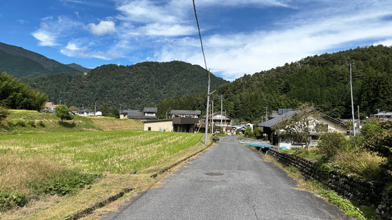
While Tokyo and Kyoto are wonderful, to truly experience Japan, consider walking the Nakasendo. As you stroll along the unchanged stone-paved paths from the Edo period, you'll feel as if you've traveled back 400 years. This route requires no special equipment or guide, allowing even international visitors to explore it on foot. On the day we walked, many travelers from abroad were also making their way along the path.
The Nakasendo, one of the five routes connecting Edo (now Tokyo) and Kyoto, stretches approximately 534 km and once had 69 post towns. In the Kisoji section, spanning Nagano and Gifu Prefectures, stone-paved paths through forests and old post towns remain accessible to all. Kisoji features 11 post towns, including Narai-juku, Fukushima-juku (Kiso-Fukushima), Tsumago-juku, and Magome-juku.
This article, based on our firsthand experience, outlines why we recommend this journey to international travelers, highlights key towns and attractions, details the popular route from Magome-juku to Tsumago-juku, and provides tips on preparation and accommodation.

Why the Nakasendo is Recommended for Foreign Travelers
The Kiso Road of the Nakasendo is easy to walk for visitors from abroad. Here are five reasons why. Based on our observations, we'll explain each one.
Many travelers from abroad are walking around, making it safe even for those traveling alone.
The main point to convey is this: The most popular section of the Nakasendo, from Magome-juku to Tsumago-juku via Magome Pass, is constantly bustling with travelers from abroad. Even on the June day we walked, there were people both in front and behind us. Despite being a mountain path, you won't feel uneasy walking alone.
Since it's not a steep mountain trail, many people were seen walking in light clothing like short sleeves and shorts. It's a path that can be confidently recommended to those without mountain hiking experience or solo travelers. At the Ichirizuka Teahouse along the way, other hikers were also taking a break.

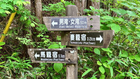
With signposts also written in Roman letters, you won't get lost even if you can't read Japanese.
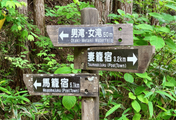
Along the road of Magome Pass, there are signposts for the Nakasendo at forks and where the road crosses. The distance to the next post town is written in both Japanese and Roman letters, so even if you can't read Japanese, you can understand the direction and how much further you need to walk. The guide signs are very comprehensive, so there's no need to worry about getting lost.


Even beginners can walk in sneakers. No admission fee or reservation required.
The distance from Magome-juku to Tsumago-juku is about 8 km. Including breaks and sightseeing, it took us about 3 hours to walk. Since Magome-juku is at a higher elevation, walking in this direction means mostly downhill, making it easier physically. Most of the path is paved with stone or asphalt, with only a small portion being dirt. Hiking boots aren't necessary; sneakers are sufficient.
There is no entrance fee for walking, and no reservation or permit is required. However, there are no streetlights along the path, so make sure to start by 2 PM at the latest.


There are services for carrying luggage, as well as English maps and menus.
Near the Magome-juku bus stop, the tourist information center offers maps in Japanese, English, Chinese, and Korean, English brochures, and booklets summarizing the history of the Nakasendo and hiking routes. It also serves as the reception for temporary luggage storage and luggage delivery services to Tsumago-juku.
Some shops along the post town and Nakasendo offer menus with photos and English descriptions, making it easy to order even if you don't understand Japanese. Despite being a small mountain town, it feels well-prepared to welcome visitors from abroad.


About 3 hours from Tokyo. Accessible by train and JR Pass.
You can reach Kisoji by train. As of November 2026, the estimated travel time to the base, Kiso-Fukushima, is as follows:
- From Tokyo
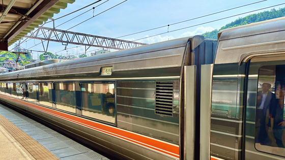
- About 2 hours and 30 minutes from Shinjuku Station to Shiojiri Station by Azusa Limited Express, then about 35 minutes to Kiso-Fukushima Station by Shinano Limited Express. Total approximately 3 hours and 10 minutes. Alternatively, you can take the Shinkansen from Tokyo Station to Nagoya and transfer to the Shinano Limited Express.
- From Nagoya
- About 1 hour and 30 minutes to Kiso-Fukushima Station by Shinano Limited Express. To Magome-juku, take a bus from Nakatsugawa Station (about 1 hour from Nagoya) for about 25 minutes, and to Tsumago-juku, take a bus from Nagiso Station for about 10 minutes.
- From Kyoto/Osaka
- Take the Shinkansen to Nagoya Station and transfer to the Shinano Limited Express.
If you have a nationwide JR Pass, you can ride the Hikari and Kodama Shinkansen, as well as the Azusa and Shinano Limited Express trains (Nozomi and Mizuho require an additional fee). Note that buses from Nakatsugawa Station to Magome-juku and from Nagiso Station to Tsumago-juku do not accept the JR Pass, IC cards, or credit cards. Payment is made in cash when alighting, so prepare small change. For more details, see How to Get to Kiso Valley from Tokyo, Shinano Limited Express Guide, and JR Pass Article.

Nakasendo Hiking: Base and Highlights
The post towns along the Kiso Road each have their own unique charm. Magome-juku and Tsumago-juku are ideal starting and ending points for hiking, while Kiso-Fukushima is recommended as a base for accommodation. From Kiso-Fukushima, you can walk along the Nakasendo to visit the famous Nezame-no-toko. For a comprehensive guide to exploring the entire Kiso Valley, refer to the Kiso Valley Guide.
Magome-juku: A Hiking Starting Point with Houses Lining the Stone-Paved Slope
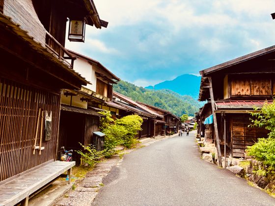
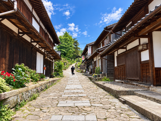
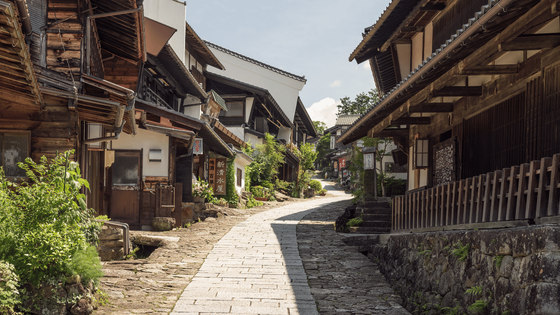
Magome-juku (Nakatsugawa City, Gifu Prefecture) is a post town with a cobblestone slope along the mountainside. Wooden houses line both sides of the slope, offering a view of the Kiso Valley as you ascend. It's the starting point of the most popular course. For more details, visit the Magome-juku article.

Before setting off, try the local specialty, Gohei Mochi. It's made by skewering mashed rice, coating it with a sweet and savory sauce, and grilling it. In Magome-juku, it takes the shape of a dumpling. The water mills scattered along the slopes add to the town's distinctive scenery.


Tsumago-juku: Japan's First Preserved Post Town. A Hiking Destination
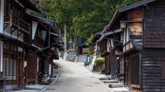
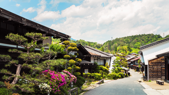
The destination beyond Magome Pass is Tsumago-juku (Nagano Prefecture). It was the first post town in Japan to focus on preserving its streetscape, with underground power lines and uniform signage. The lattice wooden houses lining both sides of the street, with mountains visible in the background, create picturesque views from any angle. For more details, please see the Tsumago-juku article.

Tsumago-juku offers several dining options, making meals after a hike one of the highlights. After walking the Magome Pass, we enjoyed Kiso soba (curry soba), which was a comforting treat for our tired bodies.

Kiso-Fukushima: Checkpoint Town. A Stop for Express Trains and a Place to Stay
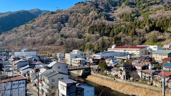
Kiso-Fukushima is a town that was home to the important checkpoint of Fukushima-juku on the Nakasendo, located roughly in the middle of the Kiso Road. It has a calm atmosphere, not overly commercialized, and is a suitable base for staying as the Shinano limited express stops here. For attractions and food, visit the Kiso-Fukushima Guide.

Nezame no Toko: White Rocks Carved by the Kiso River. Visit Along the Nakasendo Trail
Nezame no Toko is a famous spot where the Kiso River has carved out white rocks and emerald green waters. It is said to be the setting of the folktale "Urashima Taro." It's about a 10-minute bus ride or a 30-minute walk from Agematsu Station, and entry is free.
The approximately 9.4 km stretch from Kiso-Fukushima to Agematsu is part of the Nakasendo, a path along the Kiso River that takes 2 to 3 hours to walk from Fukushima-juku to Agematsu-juku. Along the way, you'll find the remains of "Kiso no Kakehashi," a difficult passage during the Edo period. If staying in Kiso-Fukushima, walking from the town to Agematsu and visiting Nezame no Toko to end the day is recommended. For more details, visit the Nezame no Toko article.

Most Popular Route: From Magome-juku to Tsumago-juku
The most popular and recommended route for first-timers on the Nakasendo is the approximately 8 km walk from Magome-juku over Magome Pass to Tsumago-juku. Along the way, you'll encounter stone pavements through forests, a teahouse at the pass, and two waterfalls, making it a scenic journey. The presence of many walkers ensures a safe experience. Here are the course details.
Distance
Approximately 8 km
Required Time
Approximately 3 hours (including breaks and sightseeing)
Recommended Direction
From Magome-juku to Tsumago-juku: A downhill route with an elevation difference of about 200m, making it easier on the body.
Departure Time
No later than 2 PM. There are no streetlights on the road.
Rates & Reservations
Admission is free. No reservation or permission is required.
Round trip
Magome-juku is about a 25-minute bus ride from Nakatsugawa Station. From Tsumago-juku to Nagiso Station, it's about a 10-minute bus ride.
Our Journey: From Suishazuka to Chaya, Over the Waterfall to Tsumago-juku
The journey begins at the stone-paved slope of Magome-juku. Once you reach the top, you can enjoy a panoramic view of the mountains, marking the start of the authentic Nakasendo walk. For a while, the road alternates between the highway and the old path, but following the signposts will keep you on track. About 15 minutes after leaving Magome-juku, you will arrive at Mizukurazuka.
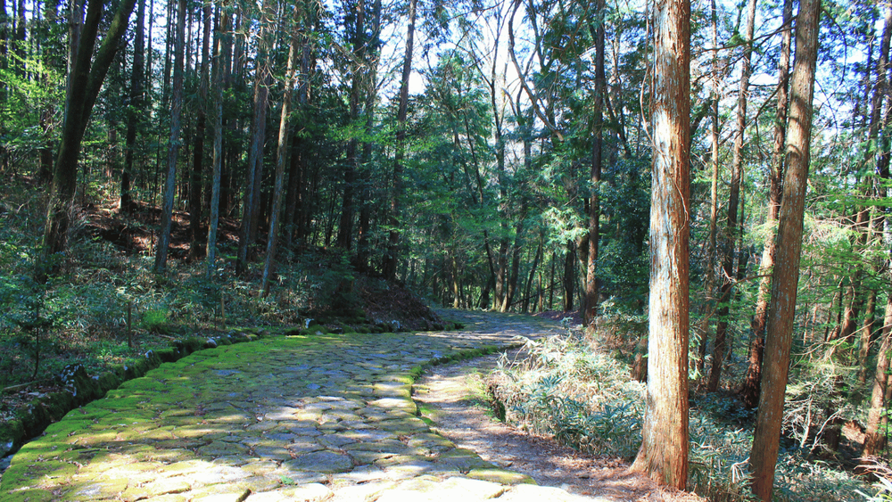
Beyond Mizukurazuka, you enter the stone-paved path through a forest of cedar and cypress. The surface changes between stone, asphalt, and dirt, keeping the walk interesting. In key spots within the forest, bear bells are hung, and we rang them a few times. The sound of the bells resonating through the forest is one of the memorable aspects of this path.
As you continue through the forest and cross the road, you will arrive at Ichiishi Tochitachiba Tea House. This has long been a resting place for travelers on the Nakasendo, and when we stopped by, they offered us tea for free. Donations are welcome. Drinking tea inside the smoke-filled building with an irori (sunken hearth) makes you feel like a traveler from the past.

After passing the teahouse, you re-enter the mountain path, which is well-maintained and perfect for forest bathing. As you proceed, you'll come across the main highlight of this trail, the Odaki (Male Waterfall) and Medaki (Female Waterfall). These two adjacent waterfalls flow side by side, with the Odaki cascading powerfully and straight, while the Medaki flows gently.

After passing the waterfall, the hike is nearing its end. As houses start to appear along the path and rice fields begin to spread out, you know Tsumago-juku is close. In June, when we walked, freshly planted seedlings lined the rice fields. Upon completing the approximately three-hour journey and entering the streets of Tsumago-juku, a sense of accomplishment and the beauty of the town hit you all at once. For a photo-rich travelogue, visit the Nakasendo Hiking Experience from Magome-juku to Tsumago-juku.

Other Walking Paths: Nojiri-juku to Suhara-juku, Fukushima-juku to Agematsu-juku, Shiroyama Nature Trail
If you're thinking, "I'd like to walk a bit more," there are other half-day trails in Kisoji.
- Nojiri-juku to Suhara-juku (about 8km, 2.5 to 3 hours): This mostly flat paved road can be walked in sneakers. The scenery changes from railway tracks to rice fields and along the Kiso River. Along the way, there's the Michi-no-Eki Okuwa rest area and the Iwaide Kannon built on a cliff. Compared to Tsumago and Magome, there are fewer walkers, offering a glimpse into local life. There are few signposts, so we used Google Maps. For more details, see Hiking from Nojiri-juku to Suhara-juku.
- Fukushima-juku to Agematsu-juku (about 9.4km, 2 to 3 hours): This trail starts right from the town of Kiso-Fukushima along the Kiso River. Beyond the goal lies Nezame-no-toko.
- Shiroyama Nature Trail (about 3.6km, about 100 minutes): Starting from Kozenji, a 10-minute walk from Kiso-Fukushima Station, this trail loops around Gongen Falls to a footbath at the goal. It's perfect for warming up before walking the Nakasendo. For more details, see Shiroyama Nature Trail Hiking Experience.


How Many Days to Walk? Day Trip, 1 Night 2 Days, 2 Nights 3 Days Guide
For a trip, walking a section of the Kisoji over 1-3 days is practical. Here's a rough guide:
- Day trip
- Magome-juku to Tsumago-juku. A day trip is possible from Nagoya.
- 1 night, 2 days
- Day 1: Magome-juku to Tsumago-juku; Day 2: Explore Kiso-Fukushima or Narai-juku.
- 2 nights, 3 days
- Day 1: Shiroyama Nature Trail; Day 2: Magome-juku to Tsumago-juku; Day 3: Nojiri-juku to Suhara-juku or Fukushima-juku to Agematsu-juku. This is our recommendation.
Preparation and Tips Before Walking
No special equipment is needed, but having a map, bear repellent, luggage, and knowledge of the season can make your walk more reassuring.
Map: Paper Walking Map and Google Maps "Old Nakasendo"
We used two maps. One is the paper "Nakasendo Walking Map" which includes English and shows the routes and highlights of each section of Kisoji. The other is Google Maps on a smartphone. The old Nakasendo road is labeled as "Old Nakasendo," allowing you to check your location even in sections with few signposts.


Bear Safety: Ring trail bells and walk during daylight hours
Bears inhabit the Kiso mountains. They usually avoid humans, but unexpected encounters can be dangerous, so it's essential to make noise to alert them of your presence. In the forest of Magome Pass, bear bells are hung in places; ring them as you proceed. Bears are more active in the early morning and evening, so it's best to walk during daylight hours.

Luggage: Have it transported from Magome-juku to Tsumago-juku and walk unburdened.
When you have large luggage like suitcases, a service that transports your bags from the Magome-juku Tourist Information Center to the Tsumago-juku Tourist Information Center is convenient. You can walk with just a small backpack, making the cobblestone slopes much easier. At the reception we saw, there was an application guide written in English. Fees and reception hours may change, so please check at the information center on the day.

Seasons, Departure Times, and Toilets
The best times for walking are the fresh green months of April to May and the autumn foliage period of October to November. When we walked the Magome Pass in June, the forest greenery was beautiful, but Japan's summer is hot, so bring extra drinks and towels. In winter, the stone paths can be slippery with lingering or frozen snow, and the days are short, so start early with non-slip shoes.
It's essential to use the restroom at the post town or station before starting your walk. If you're going from Nojiri-juku to Suhara-juku, restrooms are available at Nojiri Station, Michi-no-Eki Okuwa, and Suhara Station. The Shiroyama Nature Trail has few facilities, so stop by the public restroom near Kozenji before setting out.
What to bring
Nakasendo Hiking Essentials
For a half-day hike, this is all you need.
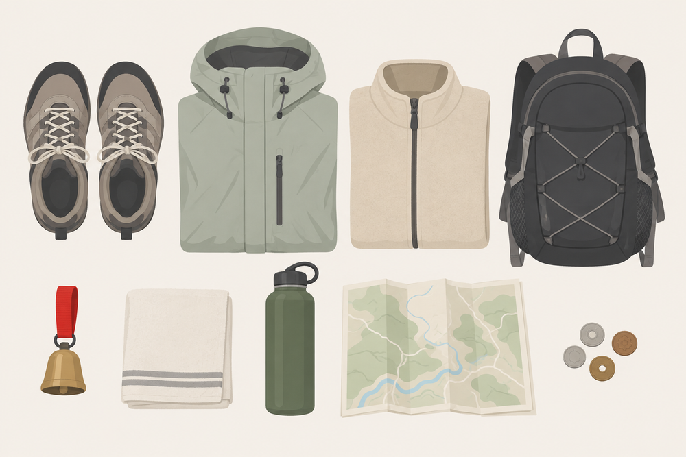
- Comfortable walking shoesSneakers are fine. Hiking boots are not necessary.
- DrinkThere are few places to buy items along the way, so prepare before departure.
- Rain gearMountain weather can be unpredictable, so having lightweight rainwear provides peace of mind.
- TowelIn summer, we especially sweat a lot.
- Small backpackWith your hands free, it's easier to walk on the cobblestone slope.
- Cash (coins)Use it for bus fares, donations at tea houses, and shopping at small stores.
- SmartphoneGoogle Maps and translation apps are helpful.
- Bear BellThere are bear bells along the path, but having your own bear bell provides extra peace of mind.
How to Stay: Enjoy a Carefree Walk with Consecutive Nights in Kiso-Fukushima
Staying in a post town and strolling through the quiet night streets is one of the pleasures of the Nakasendo. However, if you plan to walk several sections, we recommend staying multiple nights in Kiso-Fukushima, where express trains stop. Located almost in the middle of Kisoji, you can take a train in the morning to the starting post town and return by train after your walk. You can leave your large luggage at the inn, allowing you to walk with just a small backpack. There are ryokans with onsen (hot springs) along the Kiso River, perfect for resting your tired feet after a walk. From Kiso-Fukushima, you can take a train to Nakatsugawa Station, Nagiso Station, Nojiri Station, and Agematsu Station.
For details on how to stay in each post town and choose accommodations, refer to the Kiso Valley Ryokan & Inn Guide.

The Nakasendo has signposts with Roman letters and well-maintained paths suitable for walking in sneakers, making it easy for visitors from abroad. With many people walking, it's safe even if you're alone. You don't need a guide or mountain hiking experience. On your next trip to Japan, try walking the same path as travelers from 400 years ago.